Cyprus Subsea continued to provide engineering and operational support to Akvaplan-niva AS, the research and consultancy company leading the “GLIDER: Unmanned Ocean Exploration” Project.
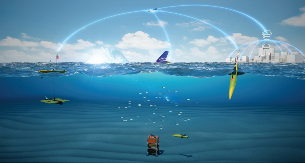
The Research Council of Norway DEMO2000 program and ConocoPhillips Norway financed the first phase of this project from 2016-2019. ConocoPhillips Norway continued support of Phase II of the project which started in 2020 and ended in 2023. During Phase I, project partners collected ocean data using three unmanned autonomous glider vehicles – a SailBuoy, WaveGlider, and Seaglider during a six month mission. These vehicles were equipped with a range of sensors for observation of meteorological, oceanographic, biological, and chemical parameters.
Another aspect of the project was to develop a system for distribution and management of the collected data. This system ensured that data are available for different marine and maritime industrial user-groups (such as offshore oil and gas, aquaculture, fisheries, offshore mining and tourism), and for government authorities and the research sector.
Goals & Objectives
One major goal of the project was to offer baseline information for decision making. This information supports profitable ocean businesses and governmental management. The collected data contributed to better understanding of the structure and function of the marine ecosystem as well as improved existing ecological, oceanographic and meteorological models.
The GLIDER Project collects a vast amount of met-ocean and environmental data. The data will be used for environmental control and to get optimal yield for investments. Our specialists draw upon decades of field-based experience to deliver high-quality assessments. By using these platforms, data collection can become more flexible. This gives the opportunity for continuous monitoring. It’s also far more economical compared to traditional data collection methods.
Salve Dahle, Director of Akvaplan-niva AS
Phase I Goals
- Identify sensors & assemble sensors & gliders
- Develop an e-infrastructure for data management
- Assess the performance of the vehicles & sensors in the Norwegian Arctic ocean
- Demonstrate the usefulness of gliders to collect biological & physical data of high resolution for ecosystem understanding
Pioneering Analytical Missions
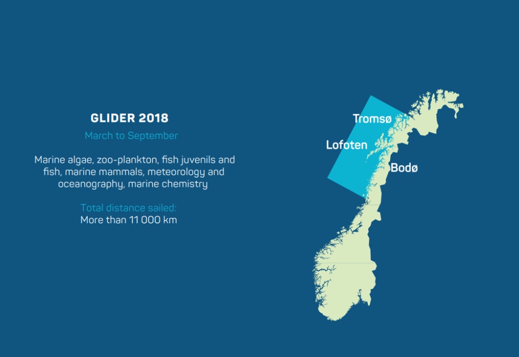
The project partners deployed these autonomous vehicles over five weeks in 2017 and six months in 2018 from Bodø in Norway. Using energy from waves, wind and solar power, and steered remotely using GPS, the vehicles toured the seas outside the Lofoten and Vesterålen Islands and along the Norwegian continental shelf break to collect information from the ocean and atmosphere.
In particular, Cyprus Subsea supported Kongsberg Maritime with sensor integration as well as the deployment and piloting of the Seaglider. Check out Kongsberg Maritime’s featured story about the first phase of this project.
Phase II Objectives
- Understanding the effects of seismic shooting & discharges of produced water from Ekofisk O&G facilities on a number of marine species in the North Sea
- Further develop the concept into an operational system to provide professional services for research & industry
Cyprus Subsea continued to provide support to the project partners during Phase II of the GLIDERS Project.
Project Partners
- Norwegian Meteorological Institute
- Norwegian Institute of Water Research
- UiT- The Arctic University of Norway
- Nord University
- Kongsberg Maritime AS
- SIMRAD
- Maritime Robotics AS
- Offshore Sensing AS
- NORCE
- Aanderaa Data Instruments AS