The Sea Traffic Management in the EAstern Mediterranean (STEAM) Project was a three-year project led by the Cyprus University of Technology (CUT) that started on 1 January 2019. STEAM was funded under the Cyprus Research Promotion Foundation’s “Integrated” projects with a budget of approximately 1 Million Euro.
The general objective of the STEAM Project was to develop the Port of Limassol to become:
- a world-class transshipment and information hub adopting modern digital technologies for the maritime sector and
- a driver for short sea shipping in the Eastern Mediterranean through enhanced services based on standardized ship and port connectivity.
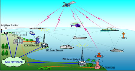
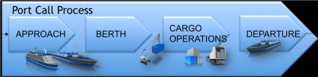
The STEAM Project was based on the foundations laid out by the EU Sea Traffic Management (STM) Validation Project. The foundational concept of a Collaborative Decision Making system for ports (PortCDM) was validated in 13 ports around Europe. The STEAM Project significantly extended and enhanced the implementation of the STM concept through the creation of a PortCDM information platform. This platform aimed to serve as the main tool for the collection and analysis of relevant data for the efficient management of the Port of Limassol.

The Cyprus Technological University (CUT) in Limassol hosted the kick-off meeting. It was attended by all partners – established maritime stakeholders of the quadruple helix. The quadruple helix consists of:
- Research/academic institutions (CUT in Cyprus & Sweden’s research institute and innovation partner, RISE.)
- Private enterprises (TOTOTHEO, DELEVANT, CSCS)
- Public authorities (Cyprus Port Authority)
- Civil society organizations (Cyprus Shipping Association
Ocean Data Maps
CSCS built a data sharing platform for the maritime sector. One of STEAM’s tasks was to incorporate innovative technological solutions to provide real-time information regarding the state of the sea. This information is of great value to all actors involved in marine navigation. STEAM’s data sharing platform increases the effectiveness, efficiency and safety of port operations. This ocean data maps display environmental monitoring data such as Ocean Biogeochemical parameters.
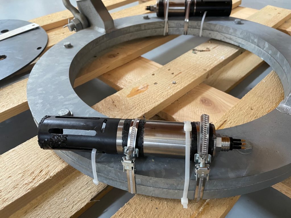
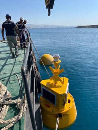
Oceanographic Buoy Integration
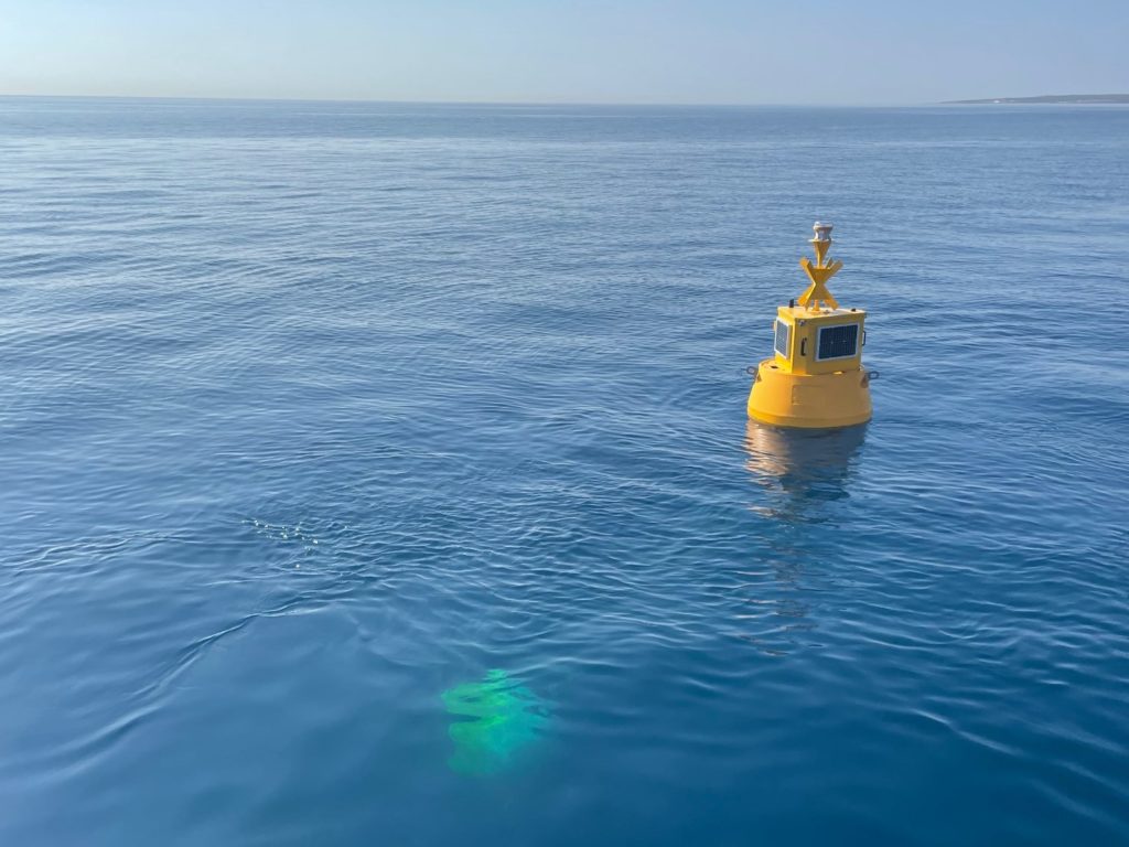
Each research buoy consisted of a central steel structure with buoyancy provided by UV stabilized rotationally-molded polyethylene floats. The floats are bolted around this structure manufactured by Mobilis.
For each buoy, Cyprus Subsea integrated the required oceanographic instruments, a communication system and a renewable energy system. The communication systems transmit the ocean data to onshore servers for stakeholders to view the measurements in real-time.
Oceanographic Instruments & LoRa Technology
The research buoys were equipped with a combination of oceanographic instruments that measured:
- conductivity
- temperature
- turbidity
- chlorophyll
- CDOM/FDOM
- refined fuels
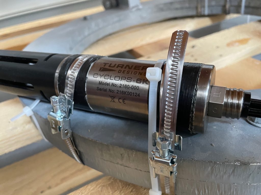


LoRa technology transmitted this ocean data to users onshore. Additionally, LoRa-based devices translate data into RF signals that can be sent and received over the air. The extremely long-range data links also require little power.
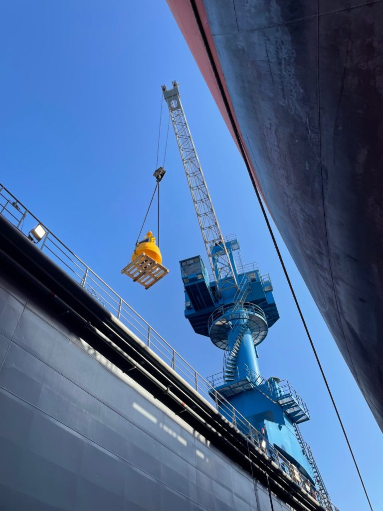
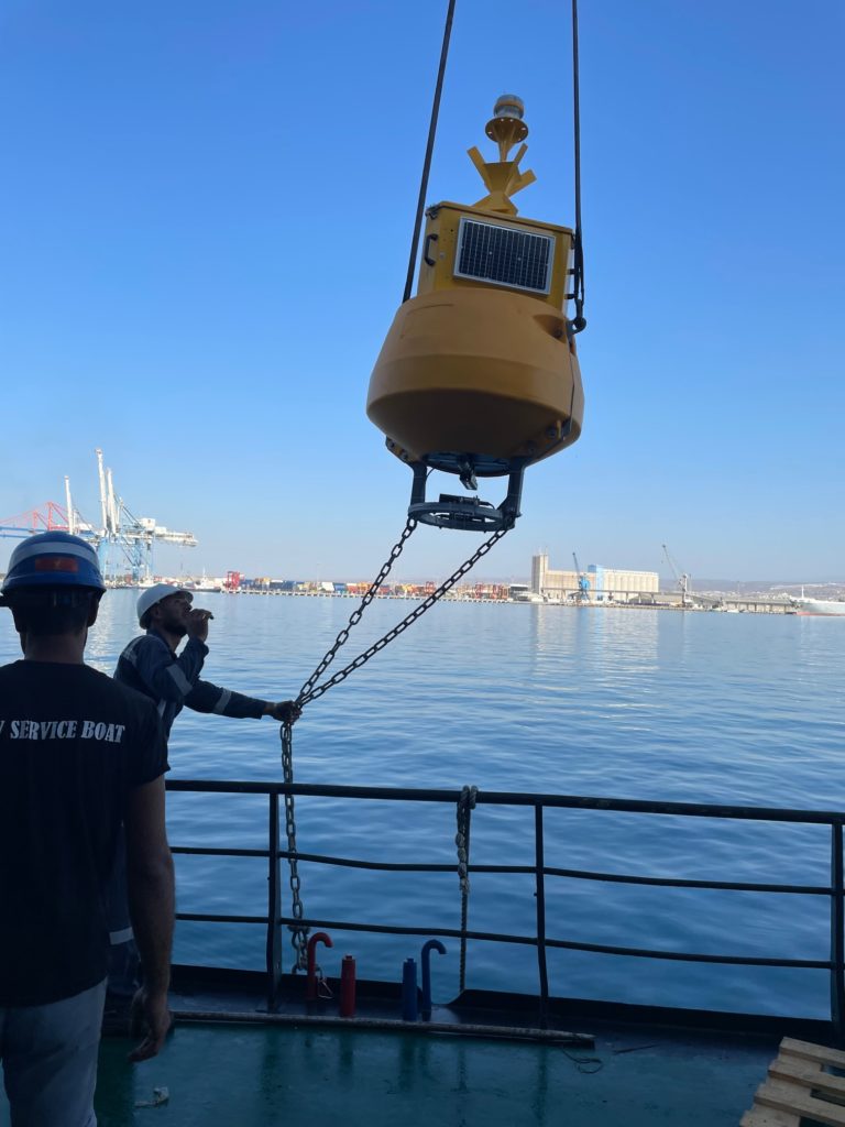
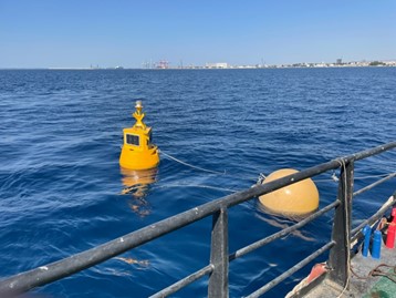
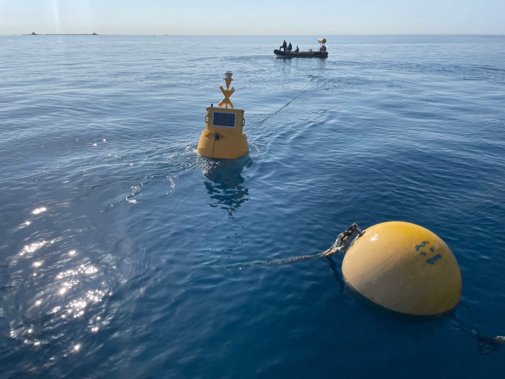
Deployment of Buoys
In addition to this integration work, Cyprus Subsea coordinated the construction of the mooring systems and final buoy deployments.
Each mooring system consisted of robust marine-grade shackles, swivels, braided rope, stud chain and subsurface float. A 1.5 ton steel-reinforced cement block sinker anchored the buoy to the seafloor. The design of the mooring system allowed each buoy to move freely within a small defined radius, while at the same time avoiding submersion during the maximum expected waves.
Data Management facilitated by ERDDAP
Real time ocean data from the various sensors were available to view and download through a web data service. ERDDAP is a data server that provides users a simple, consistent way to download subsets of gridded and tabular scientific datasets in common file formats. Subsequently, complete data sets can be uploaded regularly as the sensors are brought in for maintenance and data extraction.
Contact us for information regarding this visualization platform.

This project received funding from the European Union’s European Regional Development Fund and the Republic of Cyprus through the Research and Innovation Foundation under grant agreement No INTEGRATED/0916/0063.