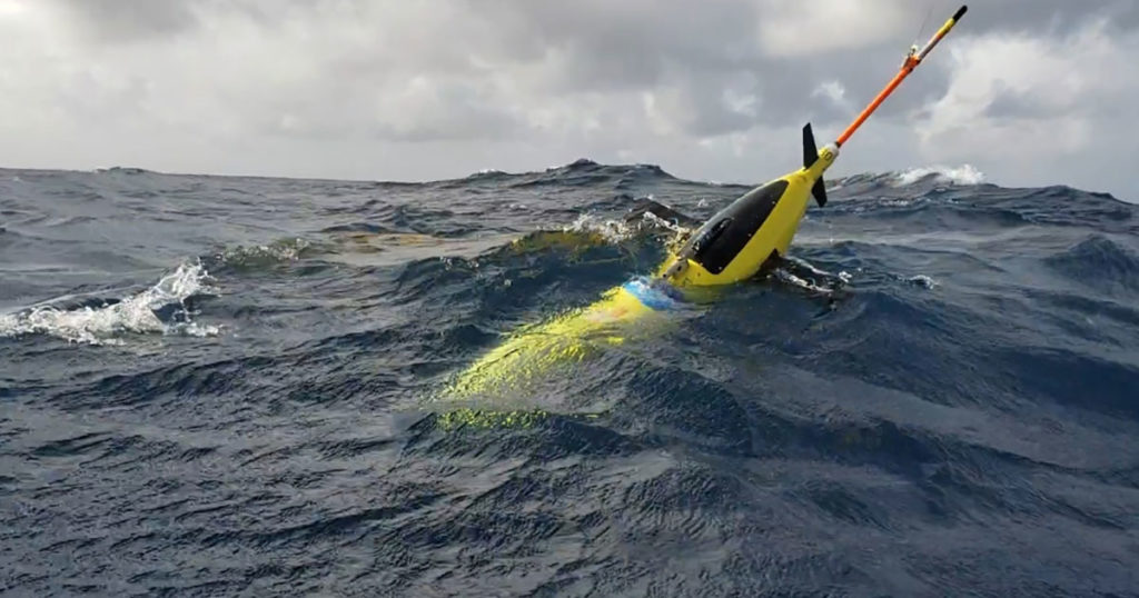
This summer, National Oceanic and Atmospheric Administration (NOAA) scientists are deploying ocean gliders to measure salinity and temperature at different depths of the Atlantic Ocean, Gulf of Mexico and Caribbean Sea.
These gliders collect critical data at various depths to enhance hurricane intensity forecasts. Both temperature and the salt content are important since warm water strengthen storms while cool waters weaken them. Salt content also affects the temperature of the ocean surface.
Local authorities recommend or order evacuation of coastal communities based on the official track and intensity forecasts guided by various global & regional dynamical and statistical models.
Gliders are unique because they operate in hurricane conditions, collect data during dives down to half mile below the sea surface and transmit data to satellites when they surface. This data improves the models that inform authorities.
The gliders help because they’re giving us high-volume, information-rich data in areas that are challenging for the models to get right.
– LCDR Benjamin LaCour, Glider Program Manager for NOAA’s Integrated Ocean Observing System
One thought on “Ocean Gliders Deployed to Improve Forecasts of Hurricane Intensity”
Comments are closed.