The 2nd Annual Dual Use Marine Technologies Workshop was co-organized by Cyprus Subsea Consulting and Services, Mar.In.E.M. and the Cyprus University of Technology.
This event was supported by the EU-funded PROteuS (PROmoting security and safeTy by crEating a MED clUster on Maritime Surveillance) project, Helzel Messetechnik GmbH and the University of Cyprus, Oceanography Centre.
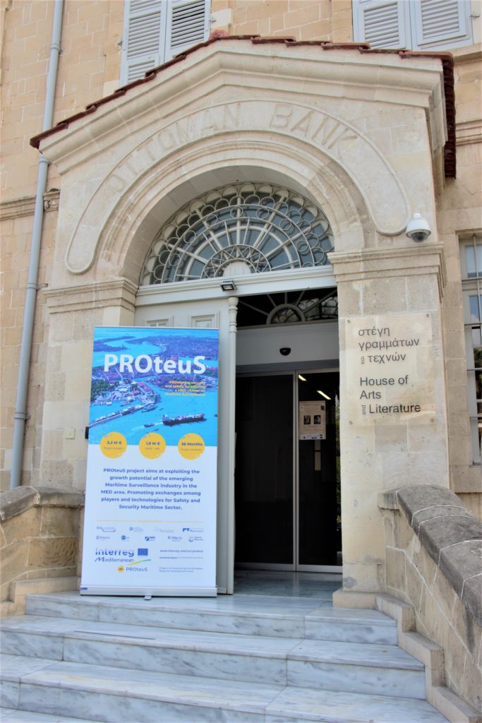
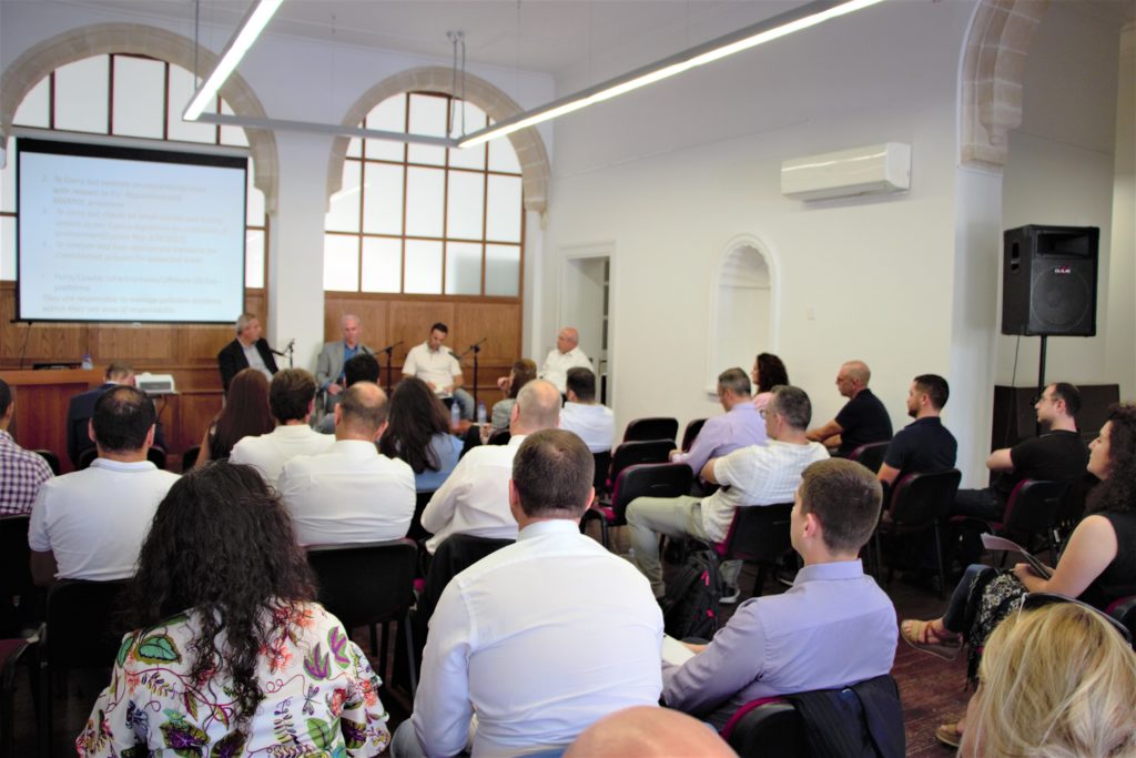
The workshop took place at the House of Arts & Literature in Larnaca, Cyprus on October 17th and 18th. Leading marine technology providers, national and international users as well as researchers in the field of marine and maritime technologies shared ideas, provided insight and encouraged synergies towards the protection of human life and natural heritage.
Opening Remarks
The Mayor of Larnaca, Mr. Andreas Vyras, and the Shipping Deputy Minister of Cyprus, Ms. Natasa Pilides, addressed the workshop participants with opening remarks. They celebrated the importance of bringing together marine stakeholders and companies to further promote the blue economy and blue growth thus leading to more jobs and opportunities. As the Shipping Deputy Minister noted, while the Cypriot public may have lost their connection to the sea, Cyprus must reconnect to its maritime heritage. Due to its geographic location at the crossroads of three continents, Europe, Asia and Africa, Cyprus is positioned to shape environmental sustainability, especially of shipping since 90% of world trade is carried by the international shipping industry.
Mayor of Larnaca
Mr. Andreas Vyras
Shipping Deputy Minister of Cyprus
Ms. Natasa Pilides
Session 1: Panel with Cypriot Government Officials
The panel discussion addressed climate change, the Cypriot marine environment, maritime accidents and unauthorized activities at sea. This session was moderated by the former Port and Marine Police Commander, Mr. Kyriakos Mavris. He led a discussion with these Cypriot government officials:
- Ministry of Agriculture, Rural Development and Environment of Cyprus Head of Climate Action Unit – Senior Environment Officer, Dr. Theodoulos Mesimeris,
- Shipping Deputy Ministry Senior Marine Surveyor, Head of the Maritime Surveillance and Anti-Pollution Unit, Mr. Themis Evriviades and
- Cyprus Port and Marine Police Superintendent B’, Mr. Michalis Koulermou.
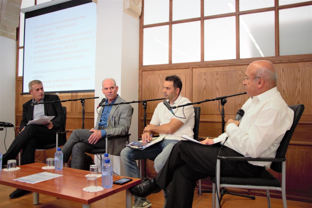
From left to right: Dr. Theodoulos Mesimeris, Mr. Themis Evriviades, Mr. Michalis Koulermou & Mr. Kyriakos Mavris
The panel discussion began with the most pressing global environmental issue of recent decades — climate change — and the practical actions necessary to stop the increase in greenhouse gas emissions. The discussion shifted to geopolitical implications of Turkey’s drilling operations in the south-west of the island within Cyprus EEZ – activity that has not been condoned by the international community. The panelists and audience members addressed the scenarios of these drilling operations resulting in an oil spill or natural gas leak as well as possible response efforts. Regarding safety and security at sea, the panelists also discussed how to protect the lives of refugees unsafely fleeing countries close to Cyprus, including the need for timely information of trafficking and unsafe vessels.
Session 2: Developments in Sonar Technology and Use
On behalf of Kongsberg Maritime SIMRAD and Mesotech, Dr. Daniel Hayes presented the basic principles and applications of scientific echosounders and sonar for underwater search and recovery teams.
The scientific applications of Kongsberg SIMRAD underwater science products were discussed: fishery research and management, ecosystem monitoring, ocean currents mapping, oceanography, acoustic mapping of thermohaline layers and natural and manmade seeps. The presentation also included the scientific platforms such as research vessels, unmanned surface platforms, autonomous underwater vessels and underwater gliders. This first talk concluded with the need for a combination of surface and underwater platforms to map deep scattering layers.
Presentation Slides: Basic Principles and Applications of Scientific Echosounders_Kongsberg Simrad
Dr. Hayes then discussed the sonar applications for Search And Recovery (SAR). A SAR operation’s three particular stages are search, locate and recover. Three sonar systems are available to conduct a SAR operation — fixed scanning, side scan and multibeam sonar systems. Deploying sonars to locate hazards before committing a diver increases human safety. A Flexview Multibeam Imaging Sonar is like a camera. While utilizing the Stand Alone Mosaic Module (SAMM) Software, the Flexview Multibeam Imaging Sonar stitches together images to create a map allowing scanning large infrastructure such as pipelines and sea walls.
Presentation Slides: Sonar for Underwater Search and Recovery Teams_Kongsberg Mesotech
Vice President of Sales of R2Sonic
Mr. Cris Sabo
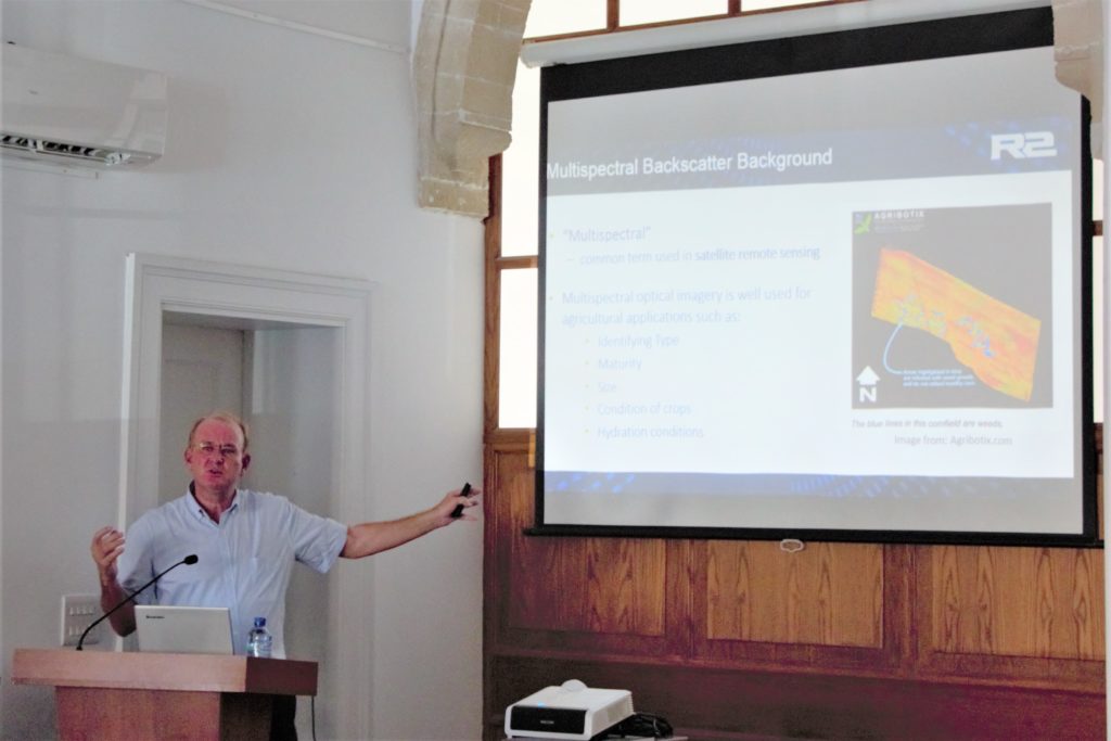
The Vice President of Sales at R2Sonic, Mr. Cris Sabo, presented a talk titled, “Leading Innovators of Bathymetric Systems & Technology”. After engaging the audience with the history of hydrographic surveying, Mr. Sabo discussed various offshore multibeam sonar applications such as cables, pipelines, ports, harbours, key walls, dredging, geological surveys, wind farm developments, mines, ship wrecks and after disasters, among other applications. R2Sonic has developed the world’s first wideband high resolution multibeam system with selectable frequencies. With Multispectral Mode survey capability, their systems collect backscatter data at multiple frequencies in a single pass which allows the user to glean more information. Mr. Sabo stated that the next generation technology will only be limited by the speed of the vessel carrying the sonar system.
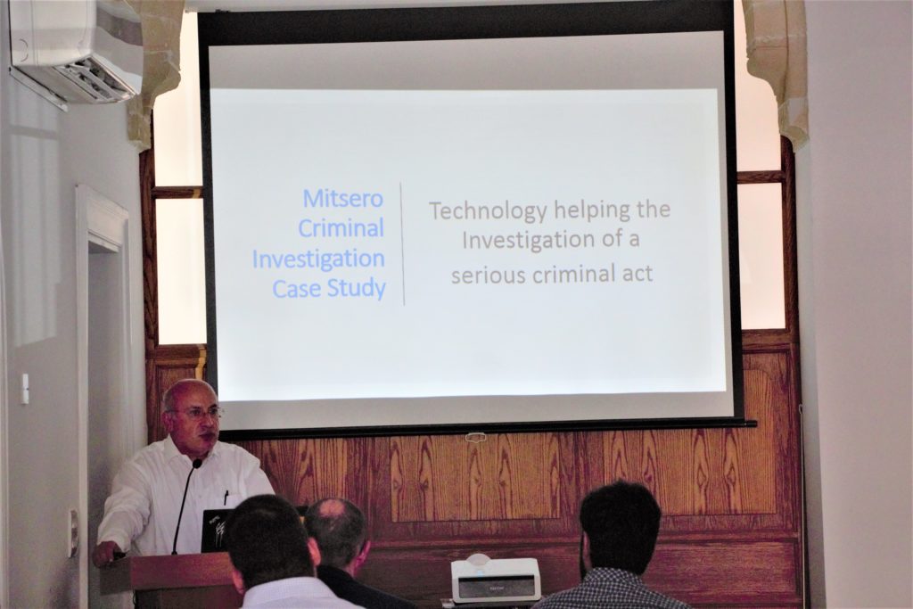
Session 3: Mitersero Criminal Investigation Case Study
Technical Director of Cyprus Subsea
Mr. Kyriakos Mavris
Mr. Kyriakos Mavris discussed the details of the search for evidence related to the criminal investigation of a Cypriot serial killer. The self confessed serial killer preyed on migrant workers and, since 2016, committed the premeditated murder of five women & two girls, the daughters of two of the victims. He disposed of their bodies in a mine shaft, firing range and lakes southwest of the capital, Nicosia. The case study focused on the toxic man-made Kokkinopezoula Lake, also known as the Mitsero Red Lake. The open pit pyrite mine was abandoned leaving a large crater. The oxidation of pyrite releases toxic metals & metalloids such as arsenic (As) thus contaminating water that pooled in the crater over the winter months. The extremely low visibility and high toxicity made the search extremely difficult, requiring several weeks. After traditional methods failed, ultimately investigators used a multibeam sonar system to locate 3 submerged suitcases containing victims. Divers were then necessary to pull the suitcases out of the acidic water, finally bringing the possibility of closure to the victims’ families.
Session 4: Marine Communications
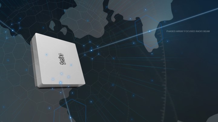
Maritime Broadband Radio (MBR)
The Area Sales Manager of Kongsberg Seatex, Mr. Vagard Haugen, presented the state of the art in marine interconnectivity with the Maritime Broadband Radio (MBR). After presenting the history of the Kongsberg Group which includes Kongsberg Digital, Kongsberg Maritime and Kongsberg Defence & Aerospace, Mr. Haugen detailed the challenges in maritime communication such as destructive interference with flat-sea fading, optimal network topology depending on near versus far communication and obstructions when moving vessels are communicating. To address these challenges, the MBR product line is a reliable, robust and dynamic communication system. The primary smart antenna is designed with up to 60 antenna elements in one antenna panel. This panel enables instantaneous beam forming, tracking and spatial addressing. The phased array radio system produces a fast moving directed beam for long range and high bandwidth that is difficult to monitor and jam. System features also include outstanding range, stability and bandwidth for non-line-of-sight and beyond line-of sight communications with a 16,5 Mbps payload.
Presentation Slides: (MBR) Maritime Broadband Radio for Robust High Bandwidth Marine Communications
Session 5: Workshop Organizers’ Initiatives and Activities
Researcher at Mar.In.E.M.
Ms. Sofia Maragkidou
A Researcher at the Maritime Institute of Eastern Mediterranean (Mar.In.E.M), Ms. Sofia Maragkidou, presented the objectives and results of the PROmoting security and safeTy by crEating a MED cluster on Maritime Surveillance (PROteuS) project. Based in Cyprus, Mar.In.E.M is a non-profit organization aimed at promoting research, technology, innovation, education & training within and for the maritime industry. Mar.In.E.M acts as a think-tank and an incubator of business opportunities on marine and maritime issues. The organization also promotes clustering activities. Mar.In.E.M, along with 8 regular and 7 associated international partners in the consortium, PROteuS, is increasing transnational activity of innovative clusters and networks of key sectors of the Mediterranean Maritime Surveillance (MS) industry. With 90 stakeholders involved with the PROteuS cluster, so far, the project is completing it studying phase which is followed by the testing and transferring phases.
Presentation Slides: The PROteuS Project
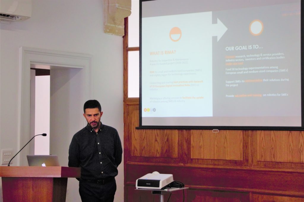
Assistant Professor in the Department of Mechanical Engineering and Materials Science at the Cyprus University of Technology
Dr. Savvas Loizou
Assistant Professor in the Department of Mechanical Engineering and Materials Science and Engineering at the Cyprus University of Technology, Dr. Savvas Loizou, shared the details of the RCDS: the Robotics, Control, and Decision System Laboratory, Competence Centre and Digital Innovation Hub. Established by Dr. Loizou in 2011, the RCDS is the first robotics laboratory in Cyprus. In addition to fundamental research, technology development, productization and innovation support, RCDS engages in underwater, underground, mobile and aerial robotics. Dr. Loizou introduced the 4-year EU-funded project named Robotics for Inspection & Maintenance (RIMA). RIMA connects research, technology and service providers, industry sectors, investors and certification bodies to support and commercialize SMEs’ solutions. The RIMA network consists of 15 European Digital Innovation Hubs (DIH), all dedicated to create connections between industry, robotics and I&M service providers with a vast experience in the field of robotics. An open call for Technology Transfer Experiments (TTEs) and Technology Demonstrators (TDs) in I&M robotics is currently out: https://rima -network.fundingbox.com.
  Presentation Slides:
 Robotics Controls Decision Systems (RCDS)
 Robotics for Inspection And Maintenance (RIMA)
Managing Director of Cyprus Subsea
Dr. Daniel Hayes
The Managing Director of Cyprus Subsea Consulting & Services, Dr. Daniel Hayes, presented how the company blends academic and technical expertise with seagoing and survey experience to carry out scientific research, commercial and governmental projects in the Eastern Mediterranean Sea, Middle East, Europe and North America.
CSCS specializes in marine robotics and autonomous systems. Since its beginning, CSCS has been serving the public and private sectors with equipment maintenance, rentals and official resales, as well as data collection, analysis and reporting services. Our prime mission is to develop, operate and maintain ocean gliders and related services for use in science and industry. Our latest product offerings include the SMART Cable and the DeepEcho Module.
Session 6: Developments in Radar Technology and Use
President of Helzel Messtechnik
Mr. Matthias Kniephoff
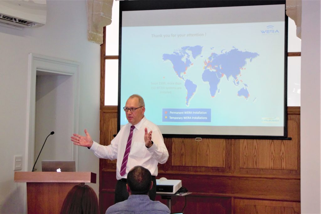
The President of Helzel Messtechnik, Mr. Matthias Kniephoff, presented two talks titled “HF Radar for Short and Long Ocean Monitoring: Samples of Various Applications” and “Proposal for a Dual Use HF Radar System on Cyprus”.
Helzel Messtechnik designed and manufactures the ocean radar system WERA. It is a shore based remote sensing system using the over the horizon radar technology to monitor ocean surface currents, waves and wind direction. A WERA site layout includes a transmission antenna, linear reception array and an air conditioned container that houses the electronics. From 5.26 MHz for longest ranges to 8.35 or 9.3 MHz for long range to 13 or 16 MHz for medium ranges, the WERA system can be configured to ensure the optimal coverage. WERA sytems also include active broadband antennas with dual frequencies along with a range of other techniques. The WERA applications include ocean current maps, wave data – heights and direction wave spectra, drift prediction for SAR, ocean current forecasting for vessel traffic services, tsunami detection and probability and identification of eddy currents. A dual use option with the Helzel OTHR system includes ship detection and tracking. Since 1999, more than 150 WERA systems have been installed worldwide.
Presentation Slides:
HF Radar for Short and Long Ocean Monitoring: Samples of Various Applications
Session 7: AUVs as Dual Use Platforms
Regional Sale Manager of Hydroid, Inc.
Mr. Nick Green
The Regional Sales Manager of Hydroid, Inc., Mr. Nick Green, presented a talk titled “Autonomous Underwater Vehicles for Seafloor Mapping & Object Detection”.
Head Engineer of Cyprus Subsea
Mr. Ehsan Abdi
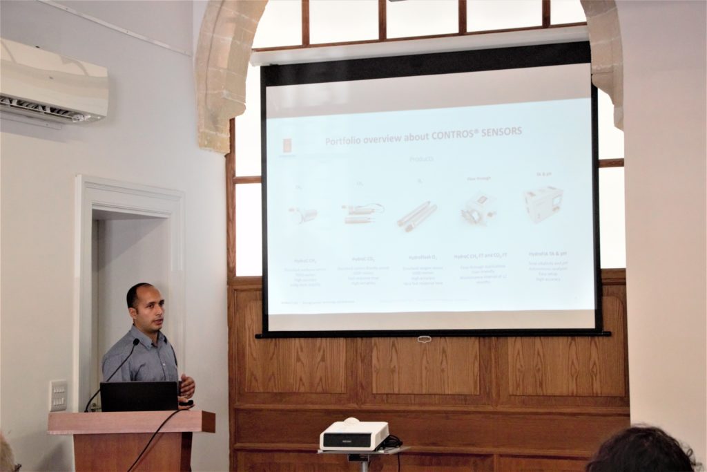
On behalf of the Managing Director of Kongsberg Maritime Contros, Mr. Daniel Esser, Mr. Ehsan Abdi presented a talk titled, “Subsea Monitoring of Critical Infrastructure”. Mr. Abdi presented the CONTROS Sensor systems that includes underwater gas sensors that measure dissolved methane (CH4), dissolved carbon dioxide (CO2) and dissolved oxygen (O2). Flow through applications measure CH4 and CO2. The CONTROS product line also includes a high accuracy autonomous analyzer that measures total alkalinity and pH. The CONTROS system also includes the K-Lander MK1 – MK3. In order to integrate the monitoring solutions, the CONTROS DPU 2.0 serves as the “brain” of the K-Lander and sensor systems. The system is powered by scalable high energy density lithium primary battery packs that are UN transport certified. From Mobile Early Leakage detection System (MELDS) for detection, localization and quanitification of oil and gas leakages to natural methane release monitoring to mammal monitoring to coastal and riverbed monitoring systems to tsunami earning system with the Geodesy Sensor Module, CONTROS manufactures compact and application driven solutions meet users’ needs worldwide.
Presentations Slides: Subsea Monitoring of Critical Infrastructure
Professor of ENSTA Paris at Sorbonne Université
Dr. Laurent Mortier
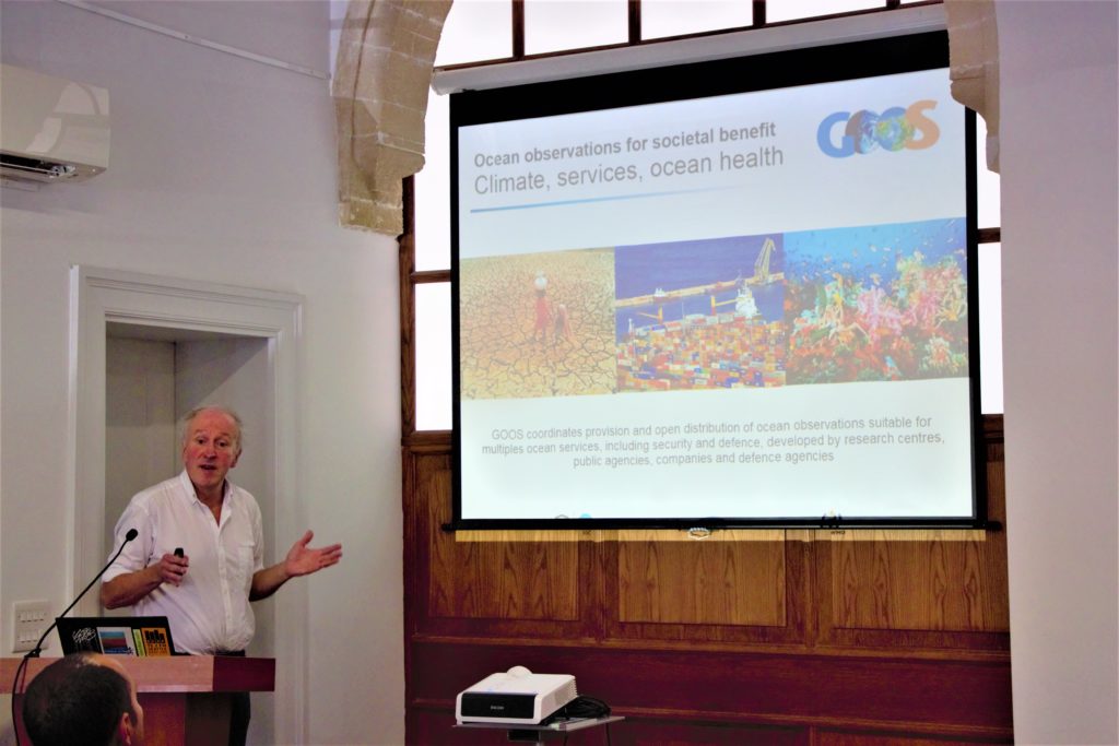
The Professor of ENSTA Paris at Sorbonne Université, Dr. Laurent Mortier, presented a talk titled “OceanGliders, Glider component of a Global Ocean Observing System: open, interoperable hydrography for multiple users”. Dr. Mortier energetically presented the glider history within the Global Ocean Observing System (GOOS) which was developed by research centres, public agencies companies and defence agencies. GOOS coordinates provision and open distribution of ocean observations suitable for multiple ocean services. With the large number of devices currently in the ocean, the challenge is to turn that data into information. In particular, glider observations and the information resulting from the data analysis are for societal benefit — from climate change science, real-time security and defence services and ocean health. From 2005 to the present day, the European Gliding Observatories (EGO) has transformed into Everyone’s Gliding Observatories, a large global community of glider practicioners that have published white papers demonstrating that innovative glider technology helps reduce uncertainties, enhances spatio-temporal sampling of the GOOS and further develops ocean management. OceanGliders is a new associated program of GOOS since glider technology is mature and gliders as a global observing network is transitioning to maturity. The OceanGliders Task Team is building a robust network of glider practitioners.
Presentation Slides: OceanGliders, Glider component of a Global Ocean Observing System